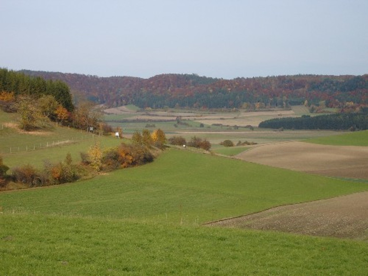
Mittlere Schwäbische Alb: extensive agricultural use and harsh climate
The low mountain range of the ‘Schwäbische Alb’ (Swabian Alb) with a width of up to 40 km stretches across approximately 220 km in the federal state of Baden-Württemberg, from the High-Rhine Valley in the Southwest to the neighbouring Franconian Alb in the Northeast, covering an area of c. 5.700 km². To the NW, the Swabian Alb is separated from the foothills by a 300–400 m high escarpment (‘Albtrauf’). To the SE, the Danube Valley forms the border to the natural geographic regions of ‘Oberschwaben’. The Swabian Alb is structured in several natural geographic regions with its central part being subdivided in the ‘Mittlere Kuppenalb’ and the ‘Mittlere Flächenalb’. The ‘Mittlere Kuppenalb’ in the Northwest is characterised by mountains forming a hilly plateau which reaches elevations of 800–850 m a.s.l. The ‘Mittlere Flächenalb’ in the southeastern part has a more levelled relief descending from about 650–750 m a.s.l. to the Danube Valley at about 520 m a.s.l. Our study region comprises an area of about 1,300 km² in both natural geographic regions.
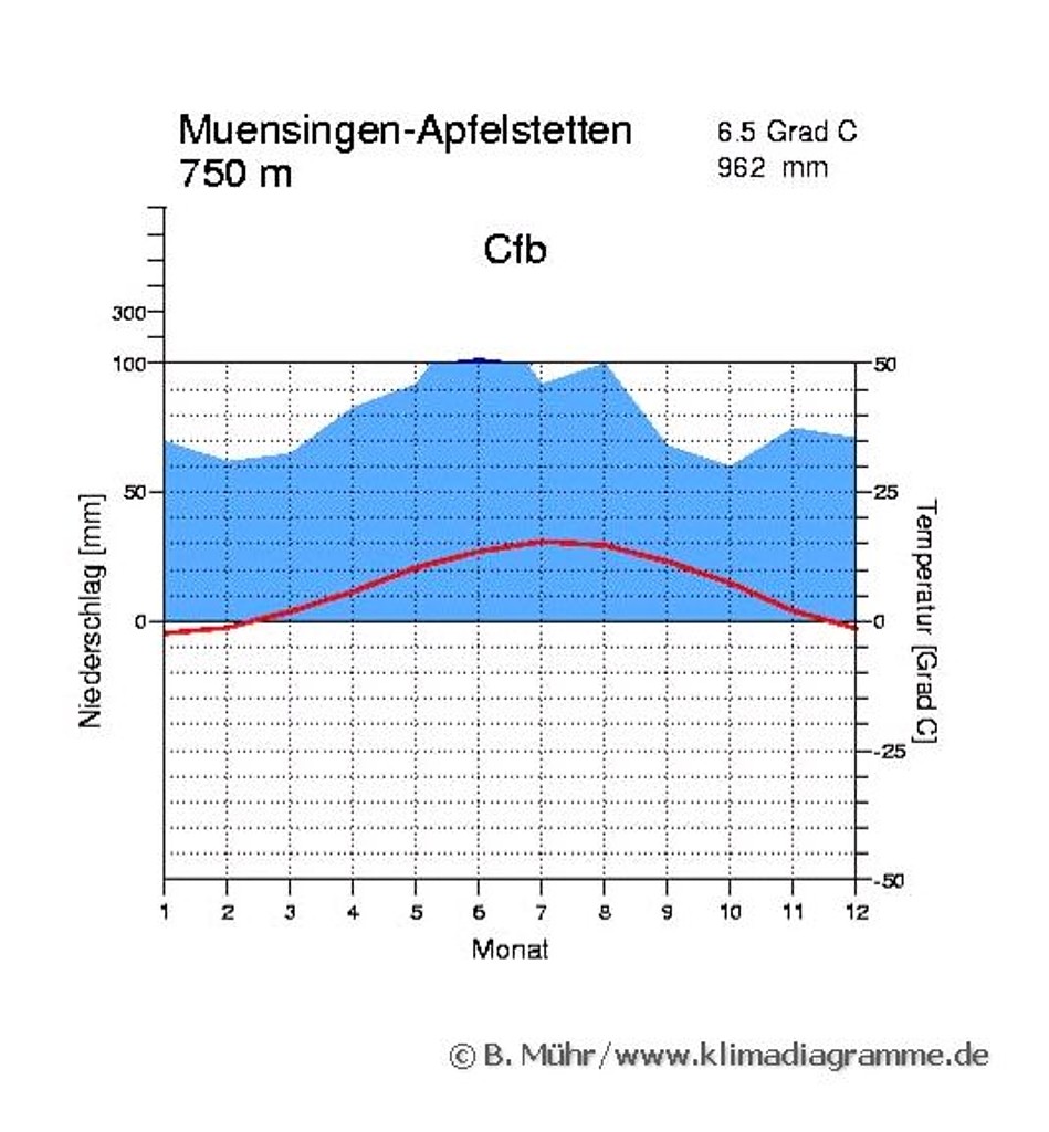
Due to its altitude, the climate of the ‘Kuppenalb’ is much colder and harsher than that of the foothills (‘Albvorland’). The annual mean temperature is about 6–7 °C, i.e. by about 2 °C lower than in the foreland. Basins of cold air are typical for this cliffy karst region where night frost may occur even during summer months. Mean annual precipitation which falls mostly during summer ranges from 800 to 1,000 mm thus being only half of the rainfall occurring at comparable altitudes in the western Black Forest. Main wind direction is westerly to southwesterly. The 'Flächenalb' due to its lower elevation is again slightly warmer and drier than the plateau.
The Swabian Alb is the largest contiguous karst region in Germany. The foothills are mostly formed by Black Jurassic and the escarpment by Brown Jurassic, whereas the plateau consists of White Jurassic. The in-situ unlayered reef limestones (‘Massenkalke’) and dolomites are the reason for the deep karstification and the development of the hilly plateau crossed by widely ramified dry valleys. Depending on the bedrock, soils are clayey loams (‘tonige Lehme’) and calcareous rendzinae (‘Kalkscherbenböden’) or shallow calcareous black soils (‘Kalkstein-Schwarzerden’), in the dry valleys decalcified loams.
The forested area amounts to about 38 % of the total area, comparable to the state average. The percentage of agriculturally used land (52 %) is similar to the situation in the Kraichgau, clearly exceeding the state average of 46 %. The proportion of crop land and permanent grass land in relation to the total agricultural land is nearly balanced. On arable land, spring barley, winter wheat and winter barley are the predominant crops. Average farm size is about 30 ha; more than 70 % of the farms are on a sideline basis.
The new UNESCO biosphere area 'Schwäbische Alb' covering an area of about 85,000 ha including the former military training area Münsingen has been established recently. The biosphere area includes also one of three exploratories for functional biodiversity research funded by DFG.