Kraichgau: intensive agricultural use and mild climate
The ‚Kraichgau’ is a fertile hilly region in the Northwest of the federal state of Baden-Württemberg, SW-Germany. It is part of the Neckar catchment area and borders on the ‚Odenwald’ low mountains in the North, the Neckar Valley in the Northeast, the Stromberg and Heuchelberg downlands in the Southeast, the Black Forest in the Southwest and the Rhine Valley in the West. The natural geographic region of the ‚Kraichgau’ is located at an altitude of 100–400 m a.s.l. and covers approximately
1,600 km². Our study region comprises about 1,400 km² of the whole Kraichgau region.
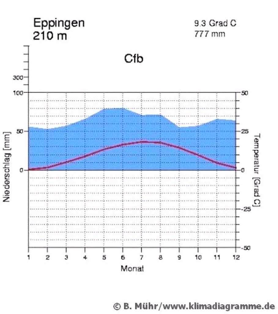
Due to its location in a basin surrounded by low mountain ranges, the Kraichgau is characterised by a mild climate with an annual mean temperature of more than 9 °C making it one of the warmest regions in Germany. Mean annual precipitation amounts to 720 to 830 mm. Intense rainfall events (> 10 mm) are typical during summer; the prevailing wind direction is southwesterly.
The tectonic depression of the Kraichgau is built up by Triassic rocks. The rocks of this gently hilly region are predominantly composed of upper shell limestone (‘Muschelkalk’) over wide areas covered by clayey keuper (‘Lettenkeuper’) and gypsum keuper (‘Gipskeuper’). At the borders to the Black Forest and the Small Odenwald low mountains the rocks consist of Bunter sandstone (‘Buntsandstein’). The hilly region is largely covered by loess which developed to pararendzinae and para-brown earths.
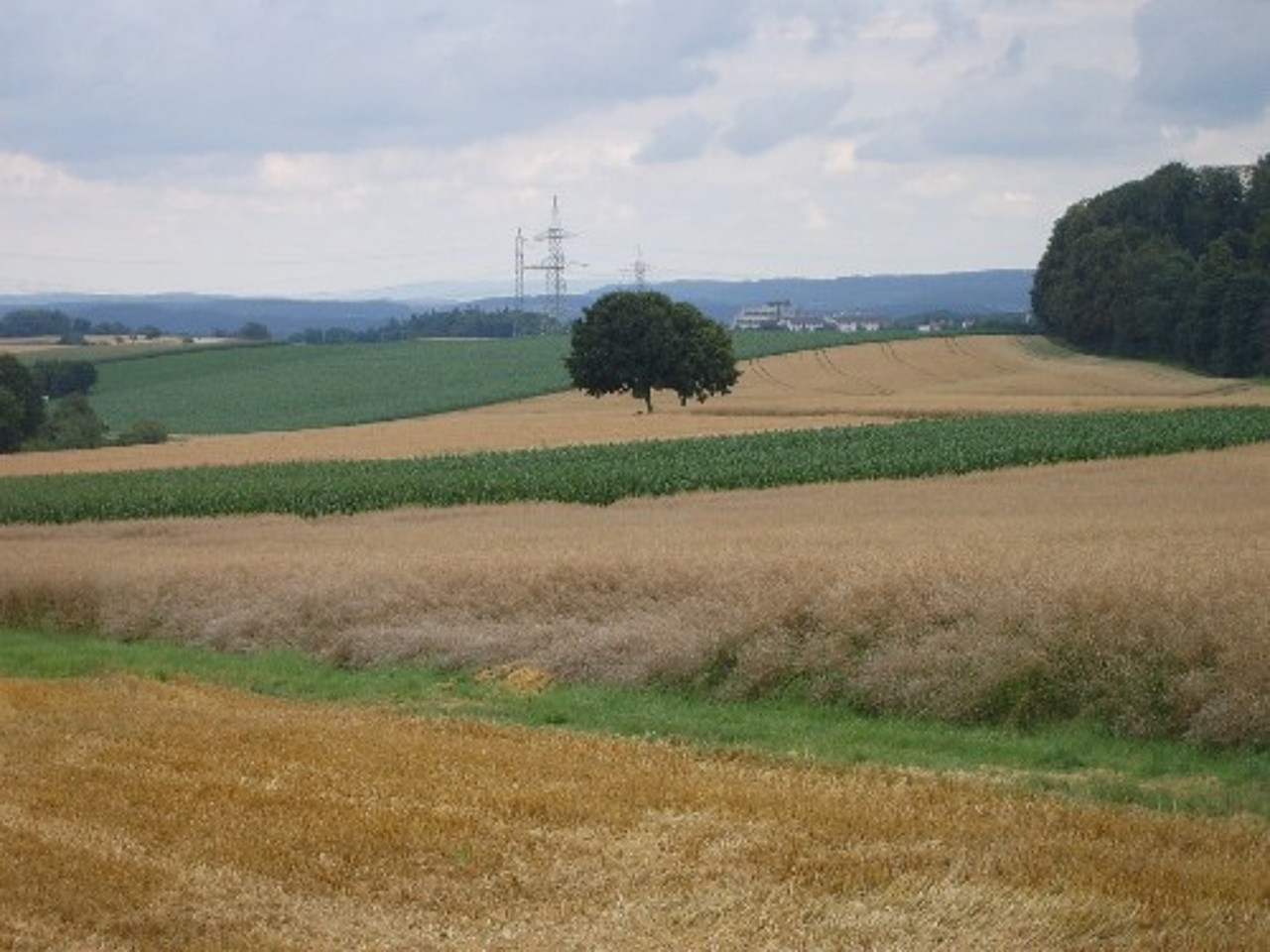
Forests cover about 29 % of the total area, which is much less than the state average of 38 %. Due to the location in a basin and the presence of fertile loess soils agronomic land use prevails. The percentage of agriculturally used land amounts to
c. 53 % of the total area which is much more than the state average of 46 %. Crop lands make up 83 % (state average 57 %) of the agriculturally used land, whereas permanent grasslands are present with only 13 % when compared to the state average of about 40 %. Farms produce mainly cash crops; crop rotation systems are very simple and in general consist of winter wheat, spring barley, maize, and sugar beet. Crop yields are above average. Farm sizes in the Kraichgau range from 30 ha (Eppingen municipality) to 48 ha (Massenbachhausen municipality).